I noticed a pond near the eastern boundary just south of I-75. It looked intriguing when I was planning this trip. I thought a point of land on the south side of the pond would be a nice place to camp.
I used Gaiagps.com to track me and used the maps on this app to find my way. The device I was using was an Iphone 6S. The Open Hiking Map layer showed a trail to the east of the parking lot. It was in the direction that I needed to head. It may have been a two track lane when the property was still a ranch. It became apparent that it had not been traveled in quite awhile. I was able to find my way along the trail detouring around thick brush and difficult areas.
The photo below shows the beginning of the trail. The track you see did not last very long. It turned into tall grass and brush.
There were some clear areas along the track as shown in the photo below.
Here is an old corrugated metal pipe culvert which indicates that a two track trail did exist.
The photo below shows a couple of power lines. They turned out to be abandoned and were probably from when the poroperty was a private ranch.
Here is another old culvert where the old two track trail went. It was completely washed out.
This photo shows a clearing.
The two photos below shows a shallow pond.
Another open area in the northern area of Deer Prairie Preserve.
After about a mile, I came to a two track trail that was being used. There are two track trails and dirt roads crisscrossing the preserve and tract. The trails are mowed as shown in the photo below or disked as shown in photos further down.
The photo below shows a grassy two track trail.
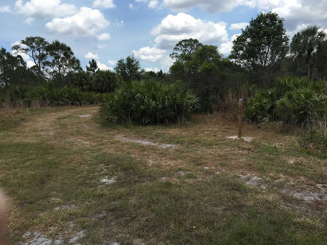
All of the intersections of trails had marker posts with either a number or letter corresponding to locations marked on the trail map that was available for free at the entrance parking area. Because of the many crisscrossing trails and dirt roads, there are many marker posts. This helps greatly infinding your location on the map.
The photo below shows another open area with pine trees in the background. The trees were mostly pine with stands of oak mixed in.
The two photos below show yellow flowers that were in bloom.
The photo below shows a pond in the distance.
This photo shows a trail that was recently tilled with a disk harrow. Walking on the tilled soil is not easy due to the large clumps. It would be easy to turn an ankle.
Here is where I ate lunch. The shade was welcome since it was getting quite hot.
A marker near where I ate lunch.
The three photos below show intersections in the two track trails and their condition.
The four photos below show Deer Prairie Creek. It was a welcome site since I was getting low on water. I had drank almost three quarts of water by the time I reached the creek. I refilled my water containers using a Sawyer filter and also filled a 64 oz Sawyer bag with water to make sure i had enough. My pack weighed 40 lbs when I started out. This water put it close to 45 lbs which was too much. Also much of the two track trails to the campsite were soft sand which added difficulty.
The photo below shows another marker at an intersection. This area had been recently burned.
The smoke in the distance shown in the photo below may have been from Myakka State Park to the north. There was controlled burning going on there.
The two photos below show evidence of more recent burning. There were some logs that were still smoldering. Going through areas like this made it seem hotter.
Here is a road intersection showing the soft sand.
Another marker post at an intersection and along an area that was recently burned.
A little vegetation in a two track trail as shown in the photo below makes the walking somewhat easier through the soft sand.
Another marker at a two track trail intersection.
Here is a photo of the western end of the pond that I planned to camp next to.


No comments:
Post a Comment